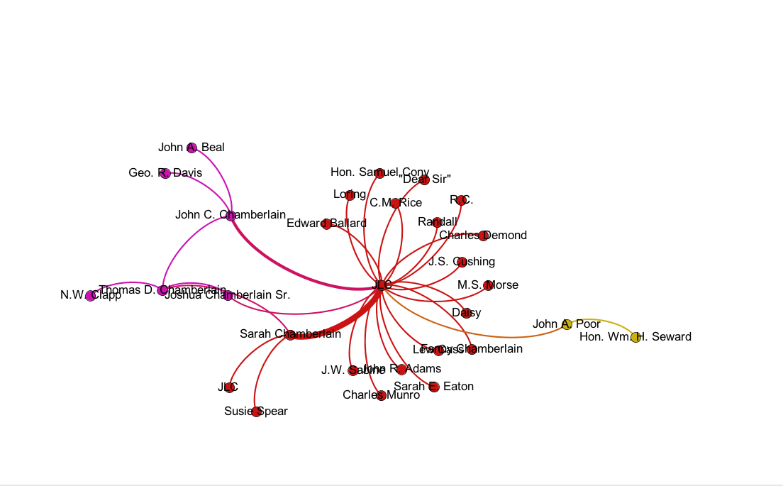
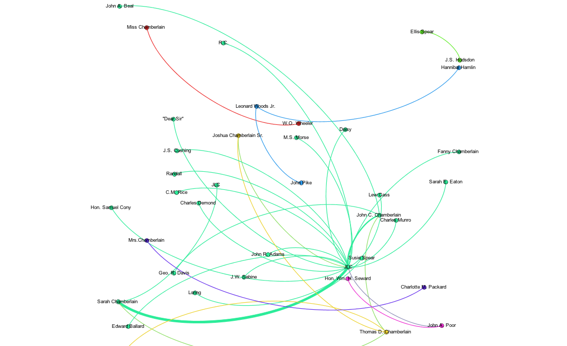
XML stands for EXtensible Markup Language. It is a language like HTML that allows you to markup your data. You can use XML to markup a letter, documents or other forms of data. One of the most prominent XML editors is called oXygen, which has XML development tools for people with all different skill levels. XML, however, does not have predefined tags. This means that the user decides what the tags are and how the document is going to be structured.
One benefit of XML is that it conveys less tangible information that accompanies data. For example, with a letter, XML enables you to tag areas of the letter that were damaged or areas that had notes in the margins. By using XML, you preserve the information found in physical documents. You can tag your text based on content and/or structure. If you did not use XML and simply accepted the text as data from a machine, you would lose the context of the document.
Data is stored in plain text format in XML. This makes it easier to share data, preserve data, and understand data. The standard markup format in XML is <tag> TEXT </tag>.
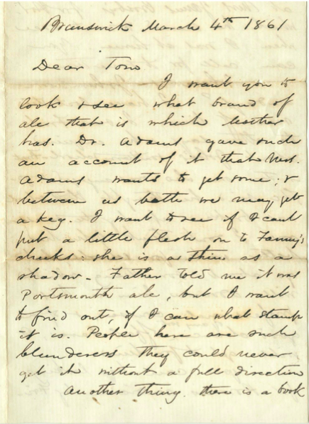
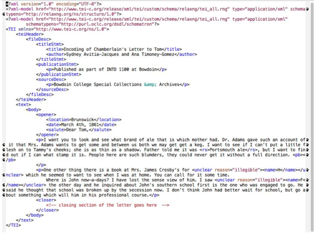
Original Joshua Chamberlain letter (left) that was then decoded and transcribed in an oXygen file (right). Credit: Ana Timoney-Gomez (created for Introduction to Digital and Computational Studies, Fall 2015).