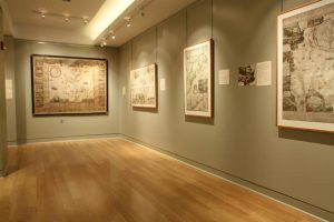
Here you will find a unique combination of historically significant rare maps and outstanding Maine and New England collections, with a gallery featuring new exhibits every two years. The Osher Map Library’s vast collections include both print and manuscript maps and atlases relating to the founding of Maine, Massachusetts, New England, and coastal navigation; the second largest public historic globe collection in the nation; and a large number of rare to one-of-a-kind maps, including the first modern printed map from 1475, and the first cartographic images of the New World engraved by Sebastian Münster. The Osher Map Library also holds an extensive collection of maps of the Arctic and Antarctic regions, as well as contemporary prints, diaries, and other items from the era of Arctic exploration.
 Address: 314 Forest Ave., Portland, ME 04101
Website: http://oshermaps.org/
Image courtesy to the Osher Map Library and Smith Center for Cartographic Education, Portland.